In the construction and infrastructure industries, understanding what lies beneath the surface is just as important as what gets built above it. Inaccurate mapping of underground utilities can lead to hazardous incidents, project delays, financial loss, and regulatory complications. That’s where PAS 128 Utility Surveyors come in—professionals who specialize in locating and mapping underground utilities according to the PAS 128 standard.
Developed by the British Standards Institution (BSI), PAS 128 provides a comprehensive, standardized methodology for utility detection and data management. This article explains who PAS 128 utility surveyors are, what the standard entails, and why their role is essential in modern construction and infrastructure projects. We’ll also explore the benefits of following PAS 128 and best practices for hiring utility surveyors.
What Is PAS 128?
PAS 128 (Publicly Available Specification 128) is a UK standard first introduced in 2014 to regulate the quality and accuracy of underground utility surveys. It was designed to bring consistency, reduce risk, and improve the reliability of utility mapping across all types of development projects.
The standard provides a classification system for the methods used and the confidence level of the data gathered. PAS 128 covers:
- Survey planning and methodology
- Equipment and techniques used
- Survey accuracy levels (Quality Levels D to A)
- Deliverables, including reports and digital models
By following PAS 128, surveyors ensure that utility data is not only accurate but also clearly documented, traceable, and easily shared with project teams.
Who Are PAS 128 Utility Surveyors?
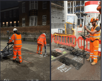
PAS 128 utility surveyors are trained professionals who conduct underground utility surveys in compliance with PAS 128. They are experts in using a variety of non-intrusive and intrusive techniques to locate underground services, such as:
- Water pipes
- Gas pipelines
- Electricity and telecom cables
- Drainage and sewer lines
- Fiber optic networks
These surveyors provide essential data to engineers, architects, and construction managers to help avoid costly utility strikes and enable better decision-making during project planning and execution.
Understanding the PAS 128 Survey Levels
PAS 128 categorizes utility surveys into four key quality levels, each indicating the method used and the accuracy of the data:
1. Quality Level D – Desktop Utility Records Search
Involves collecting and reviewing existing utility records and maps. This level provides basic information but is not suitable for design or excavation on its own.
2. Quality Level C – Site Reconnaissance
Combines Level D records with a site walkover to identify visual indicators like manholes, inspection chambers, or street signs.
3. Quality Level B – Detection Survey
Uses non-invasive technologies like ground-penetrating radar (GPR) and electromagnetic locators to detect and map utilities with a higher degree of accuracy.
4. Quality Level A – Verification
Involves physically exposing utilities (e.g., via trial holes or vacuum excavation) to confirm their exact location, depth, and condition. This is the most accurate level.
Each survey level builds on the previous, with higher levels offering more reliable and actionable data.
Key Tools and Techniques Used
PAS 128 utility surveyors employ a range of tools and methods to gather and verify data:
- Ground-Penetrating Radar (GPR): Sends radar waves into the ground to detect changes in material and locate buried utilities.
- Electromagnetic Locators: Detect electromagnetic signals from metallic pipes or cables.
- Vacuum Excavation: A safe method for physically exposing underground utilities.
- GPS and Total Stations: For precise spatial positioning of detected services.
- CAD and GIS Software: Used to compile and present survey data in detailed maps and digital models.
These tools help surveyors provide an accurate picture of what lies beneath the surface without causing unnecessary disturbance.
Benefits of Hiring PAS 128 Utility Surveyors
1. Accurate Utility Mapping
PAS 128 ensures that surveyors produce high-quality, consistent data that project teams can rely on. This accuracy is crucial for avoiding costly design changes or construction delays.
2. Reduced Risk of Utility Strikes
Utility strikes can lead to serious injury, service outages, and expensive repairs. PAS 128 utility surveyors help prevent these incidents by clearly identifying the location and depth of buried services.
3. Improved Design and Planning
With accurate utility data, engineers and architects can design buildings, roads, and infrastructure that integrate with existing services, avoiding conflicts and optimizing layouts.
4. Compliance and Due Diligence
PAS 128-compliant surveys demonstrate that a project has followed industry best practices. This is often required for regulatory approval, insurance, and legal protection.
5. Cost and Time Savings
Identifying underground utilities before excavation prevents delays, unplanned rerouting, and project downtime—ultimately saving money and keeping projects on schedule.
Best Practices for Working with PAS 128 Surveyors
To get the most value from your utility survey, follow these best practices:
1. Engage Early in the Project
Utility surveys should be one of the first steps in any development or construction project. Early data helps inform design, avoid redesigns, and ensure safety.
2. Request the Appropriate Survey Level
Determine the level of accuracy your project requires. High-risk or complex sites may need Level A verification, while simpler projects might only need Level B detection.
3. Ensure the Surveyor Is PAS 128-Certified
Work with professionals who have documented experience and qualifications in PAS 128-compliant surveying. Ask for references and review past project work.
4. Integrate Data with Design Tools
Make sure the survey data is compatible with your design platforms, such as CAD, BIM, or GIS. This ensures a smooth workflow between surveyors and designers.
5. Review and Interpret Survey Reports Carefully
Understand the quality levels, confidence ratings, and limitations noted in the report. Clear communication between the surveyor and project team is essential to avoid misinterpretations.
Conclusion
As cities grow and underground infrastructure becomes increasingly complex, PAS 128 utility surveyors are essential players in the success of modern development. They bring accuracy, safety, and compliance to the pre-construction phase, helping project teams avoid costly surprises and stay on track.
By following the PAS 128 standard, utility surveyors provide detailed, reliable, and standardized data that supports better planning, safer construction, and long-term asset management. Whether you’re building a new housing estate, upgrading a road network, or managing a major utility project, hiring PAS 128 utility surveyors is an investment in certainty, safety, and success.